Thinking about buying acreage along Route 50 near Middleburg and holding it for the long term? You see the beauty and scarcity of this corridor, but the rules, taxes, and conservation landscape can feel complex. In a few minutes, you will understand how land banking works here, what shapes value, and how to run smart due diligence before you write an offer. Let’s dive in.
What land banking means here
Land banking is the buy-and-hold of vacant or agricultural land with the aim of future appreciation, conservation benefits, or a later sale to a builder or end user. Your return depends on zoning, utility access, soils and septic feasibility, environmental constraints, and carrying costs. In the Middleburg area, you also need to consider conservation activity and community priorities that influence what is likely to be approved.
Why Route 50 near Middleburg stands out
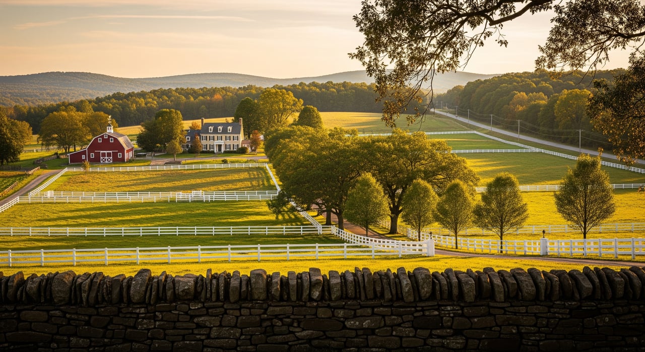
The Route 50 corridor through Middleburg is known for its rural, equestrian, and historic character. Many properties reflect a long tradition of land stewardship and scenic preservation. Regional organizations actively support conservation in this corridor, which shapes both supply and long-term value expectations. For local context on the town and setting, review Middleburg’s background and the area’s conservation highlights.
- Learn about Middleburg’s setting and heritage: Middleburg, Virginia
- See a snapshot of corridor conservation activity: Piedmont Environmental Council regional highlights
Know the rules: policy and zoning
The area around Middleburg sits in Loudoun County’s Rural Policy Area, which prioritizes rural economy uses and limits where higher-intensity development and public utilities are planned. Start by confirming a parcel’s policy area and current zoning, then review any proffers or prior legislative applications.
- Check county policy areas: Loudoun County policy areas map
- County zoning and program FAQs: Loudoun County FAQs
If you are considering subdivision potential, be aware of Loudoun’s 2024 update addressing prime agricultural soils and the cluster subdivision option, which took effect March 12, 2025. Always verify whether a property intersects the county’s prime-soils layer because it can influence how future lots are designed. You can view the mapping metadata here: Prime Agricultural Soils and Cluster Option.
Also review whether the land is enrolled in the county’s land-use assessment program. It can reduce property taxes while the land is actively farmed, forested, or in open space. Changing use or seeking a rezoning can trigger roll-back taxes, so plan your timeline and exit strategy with this in mind. The county’s FAQ page outlines program basics and enrollment details.
Carrying costs and taxes
Holding land is not cost-free. For tax year 2025, Loudoun County’s real property tax rate was set at $0.805 per $100 of assessed value. Budget for insurance, maintenance, and interest if financing is involved, and verify if any service district fees apply. Always confirm the current tax rate before modeling carrying costs: Loudoun property tax rates.
If the parcel qualifies for use-value (land-use) taxation, your annual bill may be lower while enrolled. Understand program rules, minimum acreage, and roll-back exposure if you change the land’s use or request a rezoning. The county’s FAQ page provides the starting point for requirements and timing.
Site constraints to check
Physical conditions can limit what and where you can build. Soils, depth to rock, slopes, and seasonal water tables affect septic feasibility and building envelopes. Start with county soils data and follow with a site-specific soils and perc evaluation: Loudoun soils metadata.
Wetlands, streams, and FEMA floodplain can remove acreage from practical use or add mitigation costs. Obtain a wetlands delineation and confirm floodplain status early in your feasibility period. In most rural locations near Middleburg, expect private wells and septic rather than public water and sewer. Check current public-utility service areas and capacity before you underwrite a project: Loudoun Water background.
Road access and frontage along Route 50 or local roads can influence value and future approvals. Review any planned safety or capacity improvements that could affect access or right-of-way needs: VDOT Northern Virginia projects.
Your due diligence checklist
Work through these steps before you commit to a purchase.
- Confirm policy area and zoning
- Pull the parcel’s policy area and zoning, then check for any legislative history or proffers. Start with the county’s interactive resources and FAQs.
- Title and recorded easements
- Order a title search to identify deed restrictions, access easements, or any recorded conservation easement that may limit uses.
- Soils and septic feasibility
- Order a soils and perc evaluation and review county soils data to understand septic potential and likely building envelopes. Reference: Loudoun soils metadata.
- Wetlands and floodplain
- Obtain a wetlands delineation and confirm FEMA flood zone to understand setbacks and mitigation requirements.
- Survey and access
- Get a current boundary survey. Verify road frontage, private road maintenance terms, and any right-of-way constraints.
- Utilities and service areas
- Determine whether public water or sewer is available or feasible to extend. If not, plan for well and septic. Background on the utility provider: Loudoun Water.
- Taxes and land-use enrollment
- Confirm current assessment, estimated annual tax using the adopted rate, and whether the parcel is enrolled in land-use. Understand roll-back taxes if use changes. See: Loudoun property tax rates and county FAQs.
- Conservation context
- Check for existing easements and consider whether a conservation sale or easement donation aligns with your goals. Regional context: PEC highlights.
- Market comps and positioning
- Use matched acreage and access comps from local records to build a realistic value range, noting that easements and frontage can change pricing.
- Exit strategy and timing
- Model a multi-year hold with realistic outcomes: resale to an estate or equestrian buyer, a conservation transaction, or a longer-shot rezoning.
Exit strategies and timelines
In this corridor, the most common outcomes are resale to another investor or end user who values the rural setting, or a conservation-driven transaction that secures tax benefits and long-term protection. Some investors pursue subdivision or rezoning, but approvals can be lengthy and uncertain in the Rural Policy Area. Set a multi-year or even multi-decade horizon, and avoid underwriting a deal that only works with a near-term entitlement change.
Is land banking right for you?
You can benefit from the area’s scarcity, scenic value, and conservation-minded market if you underwrite conservatively and do your homework. The upside is driven by land quality, access, and long-term demand for estate and agricultural uses. The risks include zoning and entitlement uncertainty, environmental constraints, and changing assessments that affect carrying costs. If you want a grounded plan, local data, and introductions to the right consultants, the Bill Davis Team is ready to help you move forward with clarity.
FAQs
What is the Rural Policy Area and why does it matter near Middleburg?
- Loudoun’s Rural Policy Area prioritizes rural economy uses and limits where higher-intensity development and public utilities are planned, which affects entitlement paths and timelines; see the county’s policy areas map for context.
How does Loudoun’s land-use assessment program help with holding costs?
- Qualifying agricultural, forestal, horticultural, or open-space land can be taxed at use value, reducing annual bills while enrolled; changing use or rezoning can trigger roll-back taxes, so review the county’s FAQs before you model your carry.
What is the prime agricultural soils update and how could it affect me?
- A 2024 update effective March 12, 2025, refines guidance for cluster subdivision and protects identified prime soils, which can influence lot layout and development potential; check the prime soils layer during due diligence.
What property tax rate should I use for preliminary budgeting?
- For tax year 2025, use $0.805 per $100 of assessed value as a starting point and confirm current rates on the county’s property tax page before you finalize pro formas.
Will my land likely have public water and sewer along Route 50?
- Most rural parcels rely on private wells and septic, with public service generally limited to towns or defined service areas; review current service coverage and context via Loudoun Water background and verify availability with the utility.
What environmental studies should I order before buying acreage?
- Commission a wetlands delineation and floodplain check, and order a site-specific soils and perc evaluation to confirm septic feasibility; use county soils metadata as a starting point for screening.
